FAQ
ANSWERS TO COMMON QUESTIONS ABOUT MONTE RIO REDWOODS
The park is located in western Sonoma County, south of Monte Rio. Initial public access parking will be available in a small lot on the west side of Main Street south of Creekside Park You can find a printable map of the site here.
Monte Rio Redwoods Regional Park and Open Space Preserve is 515 acres.
Regional Parks and Ag + Open Space frequently work together to establish new parks and preserves in Sonoma County. Ag + Open Space works to acquire important open spaces in Sonoma County, and then often transfers those properties to Regional Parks to manage and provide public access.
In October 2020, Regional Parks acquired the property with funding from Ag + Open Space, California State Coastal Conservancy, State Parks’ Land and Water Conservation Fund, Measure M funds, and Park Mitigation fees. Ag + Open Space retained a Conservation Easement and Recreation Conservation Covenant on the west side of the property. Read more about that transfer in this press release.
The Conservation Easement and Recreation Covenant guide the use of the property to allow for passive public recreation while protecting and enhancing natural resources. The Conservation Easement limits the extent of built developments such as parking areas, camping areas, and restrooms.
The master plan will guide Monte Rio Redwoods’ development as a park and preserve. It will describe Regional Parks’ purpose, vision and goals for the site. Based on those goals and site conditions, the plan will then identify general locations and types of trails and other public access components, describe stewardship plans for the site’s habitats, provide information on ongoing maintenance needs, and provide other guidance for ongoing operations.
Another important purpose of the master planning process is to provide opportunities for the public to offer input on access and stewardship options for the site.
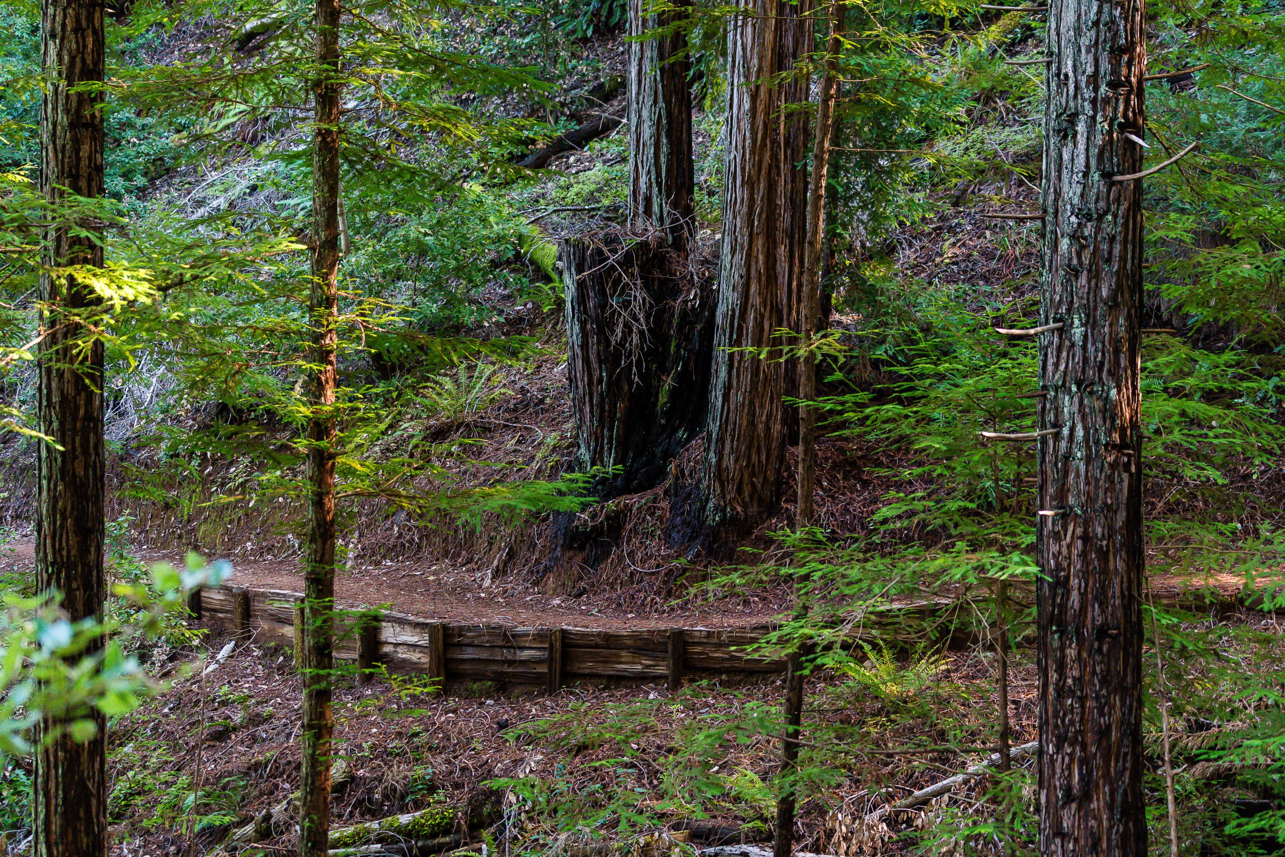
The Monte Rio Redwoods Regional Park and Open Space Preserve will eventually contain a variety of trails that provide trail experiences of different length, difficulty, and setting. Initial public access trails that are already open range from a .2-mile gentle route under the redwoods along Dutch Bill Creek to a hillier 2.4-mile route exploring the Preserve’s forested western slopes. Most of the Preserve’s trails will be multi-use. Details of specific uses(e.g. equestrian, dog access) and locations will be discussed and determined through the master planning process.
The master planning process will consider access for all users. Initial public access trails in the Preserve are open to hiking, equestrians, dogs (on leash), mountain bikes, and Class 1 e-bikes. For a map showing trail uses, please visit this page.
Ag + Open Space retains a recreation covenant that assures the property will be used, maintained and operated as a public park and open space preserve in perpetuity, consistent with the Conservation Easement protecting natural resources. Allowed public uses will be low-intensity outdoor recreation and educational activities.
Low-intensity recreation includes ways of interacting with and moving across the landscape that result in negligible impact to sensitive environmental resources like creeks and wetlands. These include hiking, biking, horseback riding, picnicking, nature study, bird watching, and public education.
A legally binding Conservation Easement covers the west side of the Preserve, requiring that the Master Plan prioritize the following outcomes in the following order: 1) natural resource preservation and protection; 2) scenic resource protection; and 3) recreational and educational uses.
Leashed dogs are currently welcome at the Preserve as at most other Sonoma County Regional Parks. Unleashed dogs are only allowed at off-leash dog facilities, such as Ragle Ranch Regional Park. There are no off-leash dog facilities at Monte Rio Redwoods.
The Master Plan will consider where leashed dogs will be allowed within the Preserve.
Regional Parks recognizes and respectfully acknowledges that the Park and Preserve is on the ancestral lands of Indigenous peoples who have been stewarding and maintaining relationships on this land for millennia. Regional Parks is engaging with local Native American Tribes to gather Tribal feedback on the development of the Park and Preserve, and will carefully evaluate any proposed design elements for impacts to sensitive Tribal resources. Regional Parks will continue to consult with them throughout the planning process. Actions taken to honor and acknowledge this place as Indigenous land will come out of this consultation process.
In addition, Regional Parks anticipates that the Park and Preserve’s interpretive programming will speak to Indigenous history and land stewardship in the area. Additional ideas for honoring and acknowledging this place as Indigenous land are welcome! Please share your ideas via upcoming surveys (linked on this website).
Understanding and addressing wildfire hazards and risks is crucial to maintaining the health and safety of the Park and Preserve, nearby properties, and Sonoma County. The region is increasingly vulnerable to impacts from catastrophic wildfires, amplified by complex factors including hotter temperatures, drought, stronger winds, and a buildup of dense fuels (vegetation) from decades of fire suppression.
Many plant communities in the property are adapted to fire, and thrive on (or even depend on) small, frequent burns that characterized the centuries of Indigenous land management in the region. While the particular measures for fuel management are not yet selected, efforts will focus on reducing fuel loads, reducing unintentional ignitions, supporting fire-adapted habitats, promoting education, designing/incorporating infrastructure to support firefighting efforts, and creating climate durable infrastructure in keeping with Regional Parks’ strategic plan.
Regional Parks has already begun improving the wildfire readiness of the property, by establishing shaded fuel breaks, reducing fuel loads through thinning and pile burning, and providing better access to CAL FIRE in the event of a wildfire. Parks and its partners will continue to develop and implement fire-adaptive management strategies at this Park and Preserve to make the forests more resilient to climate change and future wildfires.
We anticipate several facilities will be proposed during the master planning process based on the allowable uses included in the Conservation Easement.
We anticipate picnic sites, educational programs, guided walks, and self-guided interpretive trails will also be considered during the planning process. Other amenities will depend on your feedback and could include nature-based facilities like a hike-in camping area.
All proposed facilities will need approval as consistent with the Conservation Easement for the property by Ag + Open Space.
Hike-in camping and permitted campfires and/or camp stoves are currently being considered at the Preserve as part of the Master Plan process. RV camping is not anticipated due to parking limitations.
One small initial public access parking lot for the Preserve is constructed and will be available soon on the westside of Main Street near the northern end of the site. There is also limited roadside parking along Main Street, but there are safety concerns with encouraging the public to park here.
Exploring other parking and access options will be part of the master planning process. A Regional Parks shuttle stop, and a regional bike and pedestrian pathway linking to the town of Monte Rio, will be considered.
This area is on or near the ancestral lands of the Southern Pomo who are the original caretakers of this area. We respectfully acknowledge the Indigenous peoples who have been stewarding and maintaining relationships on this land as knowledge keepers for millennia.
In more recent years, a narrow gauge railroad was built through the site in the late 1800s, spurring economic development of the area. Between the 1860s and the 1910s, the economic focus of the area was logging of the redwood forests. The forests of the Preserve were first harvested (clear-cut) in the 1880s. Recreational tourism also became an important part of the economy, with many summer camps and resorts established along the Russian River. In 1927, the Torr family purchased the property, continuing logging until 1998. In 2020, the property was purchased from the Torr family by Sonoma County Ag + Open Space.
The Park and Preserve is expected to be open from 7 am to sunset for day-use activities like other Sonoma County Regional Parks. There are a number of small “building envelopes” allowed under the Conservation Easement, and they are expected to be used to provide housing and/or an office for rangers or park staff. This will provide additional site safety and security. The property will be patrolled and managed by rangers and resource management and maintenance staff. The Master Plan will include a plan for emergency evacuation to account for fires, flooding, and other potential safety events or issues.
Additional Questions?
We’re happy to answer whatever questions you may have.